Dry and hot conditions today, breezy to windy, fire danger increases
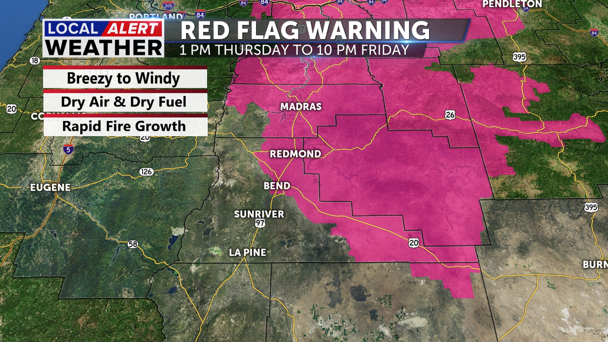
The National Weather Service has issued a Red Flag Warning for most of Central Oregon and points north ending Friday evening. The winds will be from the NW today and tonight, transporting the smoke from the Cram Fire toward Crook County, then shift Friday to a westerly direction, pushing the smoke east, away from Central Oregon.
The Cram Fire is nearly at 100k acres, as the winds continue to change direction each day. the Southern and Southeastern flank is a concern today and tonight with a NW and Northerly flow. Tomorrow the winds shift and come in from the SW and that puts the northern flank in jeopardy. Dozer lines and containment efforts have be focused in many locations, but the SW corner of the fire has been aggressively managed.

Temperatures today will be in the low to middle 90s, continuing to dry out our already parched landscape. Please make sure to stay wildfire aware with respect to anything that may start a fire in the region. We could experience rapid fire growth if a spark starts a flame.
Friday will be breezy to windy as well with highs in the low 90s. The Red Flag Warning remains. The resources attacking and containing the Cram Fire are doing an excellent job. Although they have been and will be challenged by the weather and terrain, they continue to establish control lines and stay on the ever-changing wind flows that make fighting this fire so challenging.
The weekend will be more reminiscent of a mid to late July day with highs in the 80s and mostly sunny skies. Expect to see some cloud cover arriving late Sunday as the region may get some isolated showers and storms Monday.
Don’t forget to download the KTVZ weather app to stay safe and informed.
iOS: https://apps.apple.com/us/app/ktvz-local-alert-weather-app/id1088330817
Android: https://play.google.com/store/apps/details?id=com.ktvz.android.weather&hl=en_US


